Montserrat, West Indies · Field deployment, March 2018
Heavy rain on the slopes of Soufrière Hills Volcano can sweep loose volcanic sediment into the normally dry Belham Valley. The resulting floods and debris flows, known locally as lahars, can damage bridges and threaten communities downstream. Could instruments near the channel detect a flow and follow its progress down the valley?
The field experiment
Glenn Thompson and Jochen Braunmiller proposed the pilot study in 2017 under the title Seismic and infrasound characterization of rainfall-induced lahars in the Belham Valley on Montserrat, West Indies. In March 2018, the project installed four USF stations within 50 metres of the main channel, spanning about 1.7 kilometres from MTB1 upstream to MTB4 downstream. Each station paired a broadband seismometer with an infrasound sensor to record both ground motion and changes in air pressure.
A flow recorded on 3 April 2018
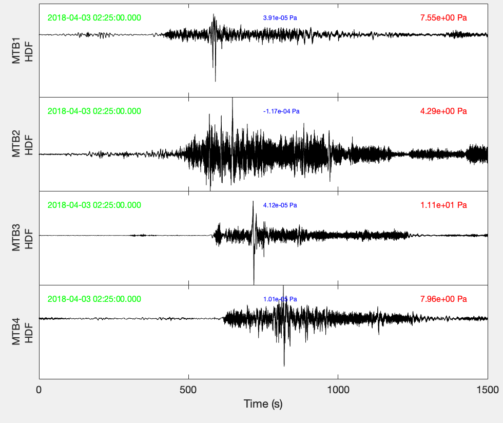
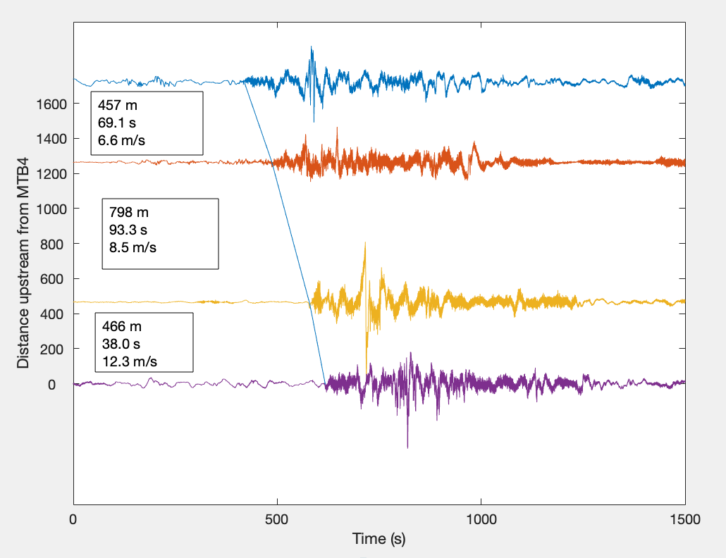
Each of the four pressure sensors recorded the passage of a flow. The signal grew at the upstream station first and emerged progressively later downstream. Comparing the timing at adjacent stations gave the team a way to estimate how quickly the flow moved between them.
Monitoring questions
In collaboration with the Montserrat Volcano Observatory (MVO), the project sought to compare the near-channel recordings with MVO seismic and rainfall observations. How much rain precedes a flow? How reliably can a more distant station distinguish a lahar from volcanic tremor or a pyroclastic flow? These questions bear on the feasibility of a warning system and on where sensors would need to be placed.